ChatGPT
I came across this gem the other day on Reddit:
I’ve seen a lot of people claim that frequent use of em dashes is a telltale sign something has been authored by ChatGPT. For as long as I can remember – probably since college – I’ve used em dashes a lot in almost everything I write. If you scan the stuff I’ve written on this site I’m sure you’ll find them littered throughout.
So not only do I need to worry about AI replacing a majority of white-collar workers, which will cause massive unemplyment and crash the economy because no one will have any money to buy things. Which, in turn, will crash the stock market since the companies currently spending hundreds of billions of dollars on AI “initiatives” won’t see any profitable return on their investment because, well, there aren’t any humans to buy stuff. Which means all our savings and investments will be worth pennies on the dollar.
The only way out of this mess will be some sort of Universal Basic Income, which would allow the humans replaced by AI to keep living. But Republicans, who basically control the government at this point, can’t even agree that asbestos is bad, clean air is good, and Nazis are bad. How on earth are we going to ever pass legislation as contentious as UBI? But maybe none of this will even matter if AI powered super-soldiers get loose or AI-controlled weapons go off-script and start “learning.”
So in addition to all these AI-induced worries you’re telling me that now I have to worry people will think everything I write has been generated by some type of AI service? What kind of hellscape is this?
IDLES
I’ve been on an IDLES kick lately, completely obsessed with them. They feel like the band we need at this time.
Switzerland
It’s our 25th wedding anniversary this year so to celebrate we wanted to go on a big trip that involved an airplane and a passport. Late last year we settled on Switzerland, which seemed to check all the boxes for us. Big mountains, lakes, hiking – basically an amazing place with lots of natural beauty. Another huge bonus was the fact that we could do the entire trip without relying on an automobile, which is something I’m always interested in.
We flew into Zurich and then went right to Lucerne and spent a few days exploring the city, doing some mountain excursions in the area, and taking a boat trip on Lake Lucerne. Lucerne was probably the biggest surprise of the trip. I was expecting a sleepy little town, but instead found a pretty bustling urban center that was very cool. We both really enjoyed both the city and all of the mountains in the surrounding area.
After Lucerne we went to the Bernese Oberland area for a few days, staying at both Grindelwald and Wengen. We did some amazing mountain excursions and hiking as well as a nice boat trip to Brienz. Wengen had a really cool vibe. It’s car-free and nestled at the foot of the Jungfrau. It’s very quiet and peaceful and was something different from the busier, but still amazing, Grindelwald.
We left Wengen and headed south to Zermatt for a couple days. We were lucky enough to have a really great weather where we could explore the mountains and capture some amazing views of the Matterhorn. Zermatt is also car-free, but was quite busy. There were lots of people there hiking and doing mountain adventures so it had a great energy around the city. It seems like the entire town is made up of hotels, restaurants, and shops so it feels like one huge resort.
We took the Glacier Express train from Zermatt to St. Moritz, which was a neat experience. We got to see so many different areas of the country on the eight hour ride. We got off that train at St. Moritz and made our way back to Zurich. We spent a night there and flew out the next day.
I had such an amazing time and think it was one of the top trips we’ve done. I loved every place we visited and had so much fun navigating around the country using the Swiss public transportation system. The places we went and the views we saw were some of the most stunning I’ve ever seen in my life. The Alps are magical. Many of the places we visited literally took my breath away and I was just in awe of how big and grand the views were. Seriously hard to describe how great it is. I was fully expecting most of the hillsides to be brown since it was basically fall, but that wasn’t the case at all. Everything was lush green and the forests we walked through were like rain forests in many places.
I love being in places that feel “international” and Switzerland definitely made that impression on me. I’m guessing that’s mostly due to it being a really popular European tourist destination and is probably something you’d experience in other touristy areas in Europe. Still, I loved seeing all of the different people and hearing all of the different spoken languages as you walked down the street or just paid attention on the bus or train.
I’m really proud that we were able to put together a trip from scratch and it worked out. Better than worked out, I guess. It was amazing. There were a couple points early in the planning where we were overwhelmed and were like, “Let’s just go on a tour.” But we didn’t. We did the research and put together something we thought would be great and it was.
All in all, I’m just so thankful that we were able to take such an awesome trip. We’re celebrating our 50 year birthdays as well as our 25th wedding anniversary this year and I feel like the trip was a special one that matched a big year in our lives. I think it will also give us the confidence to plan more international travel in the years to come.
I’ve got a zillion photos and videos from the trip so it’s difficult to pick just a few. But here’s an attempt to capture some of what we saw.
 View up at the summit of Fronalpstock (accessible via chairlift from Stoos)
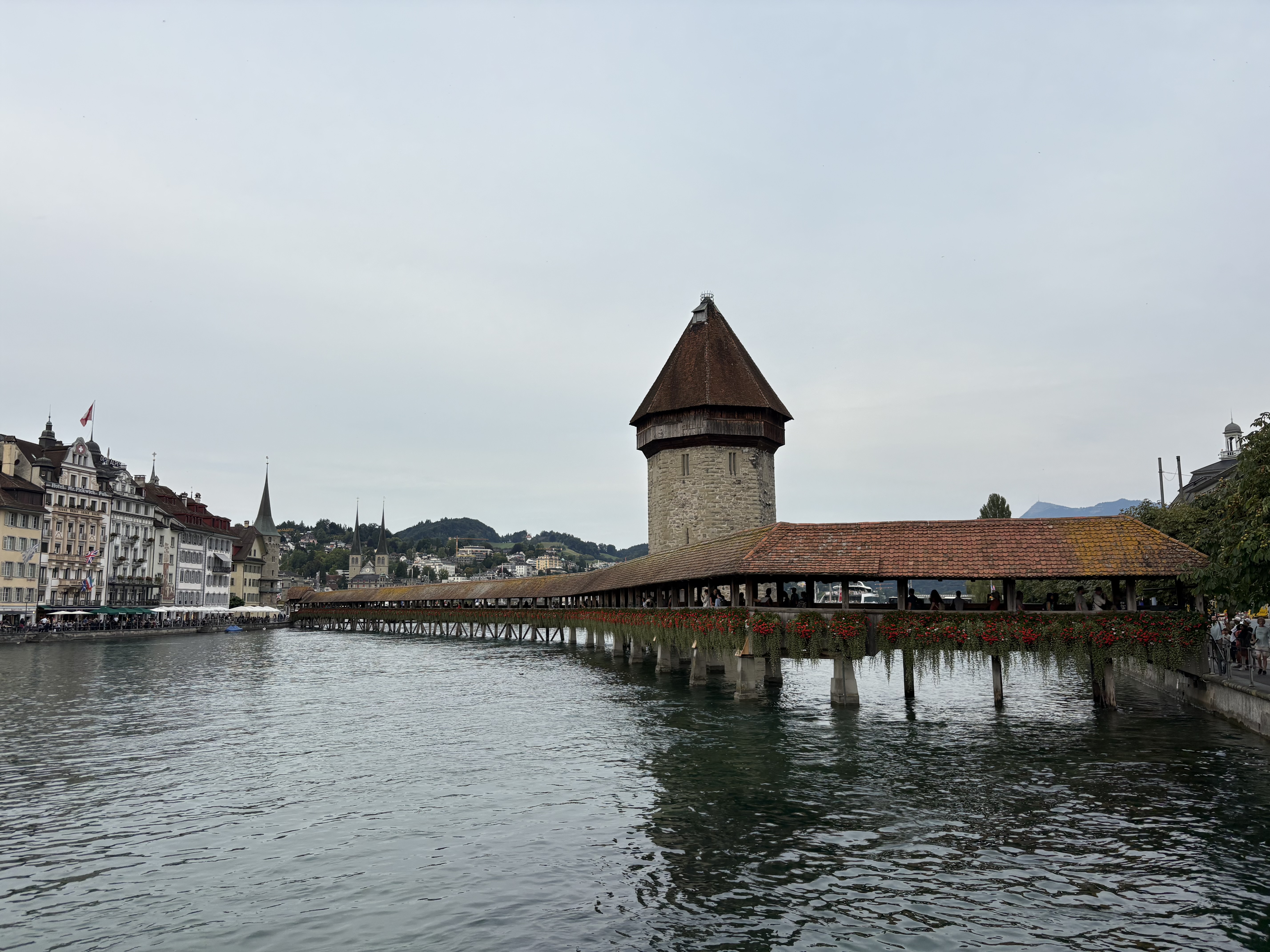 The Chapel bridge in Lucerne
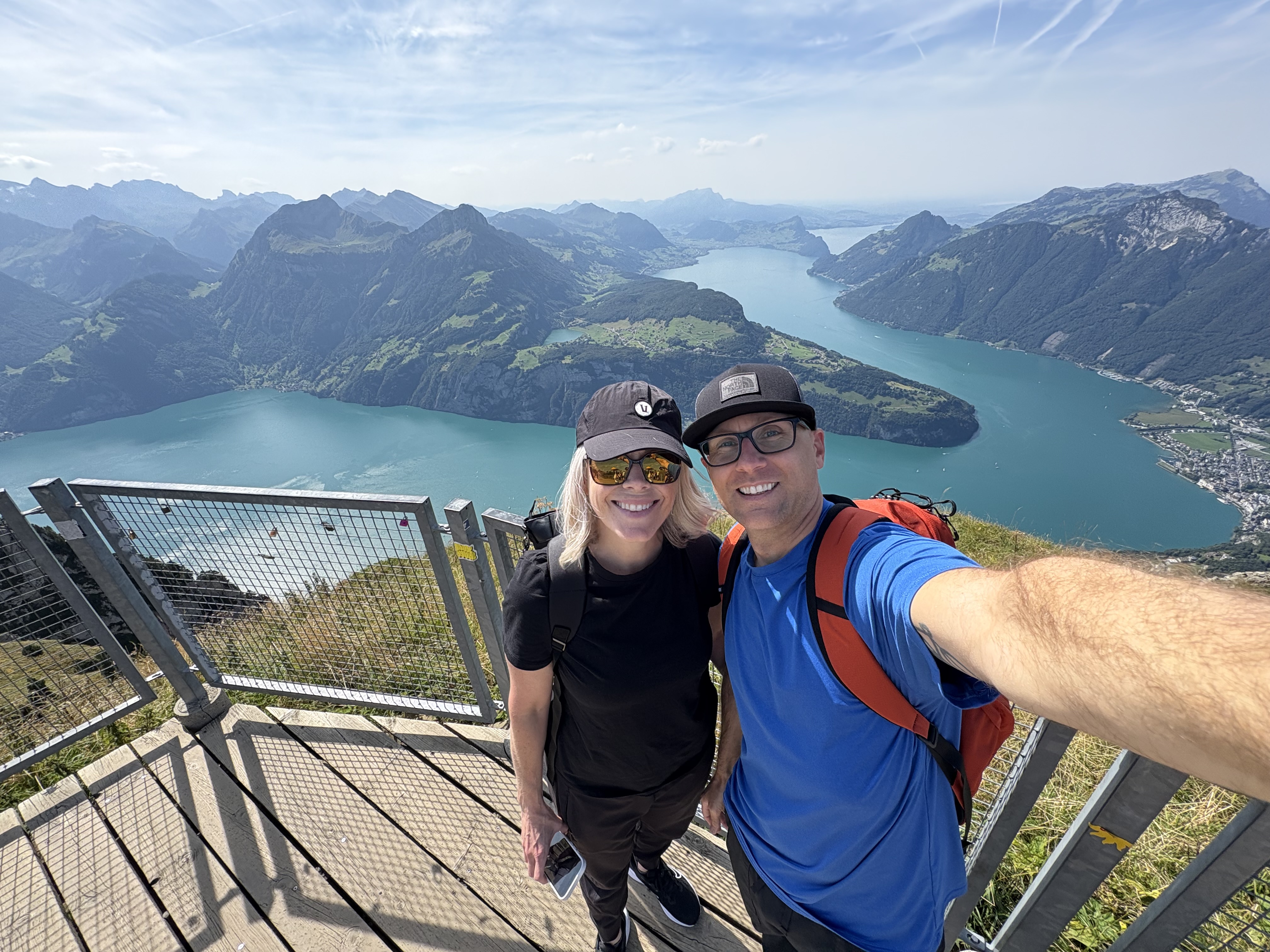
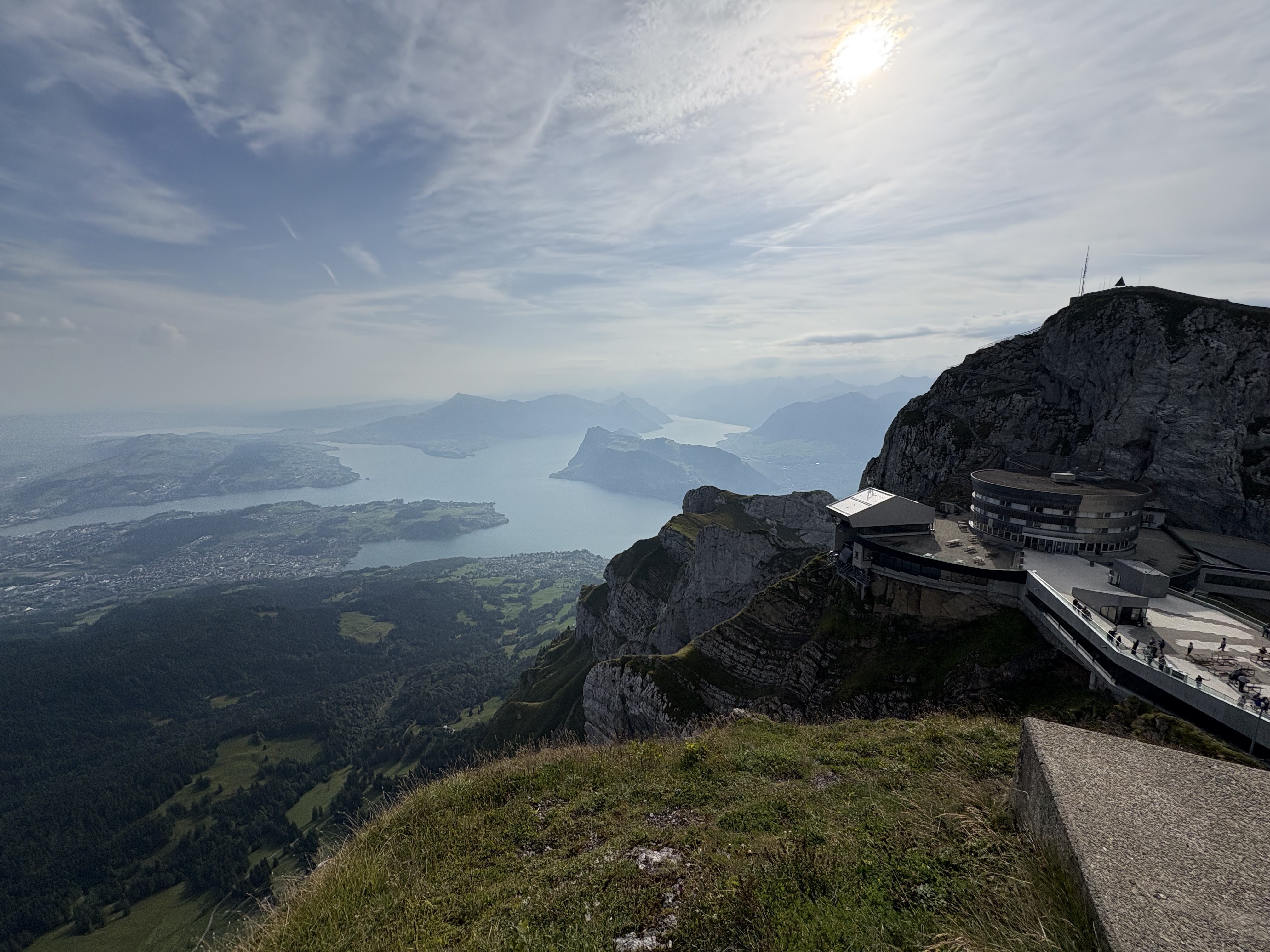 View from Mount Pilatus
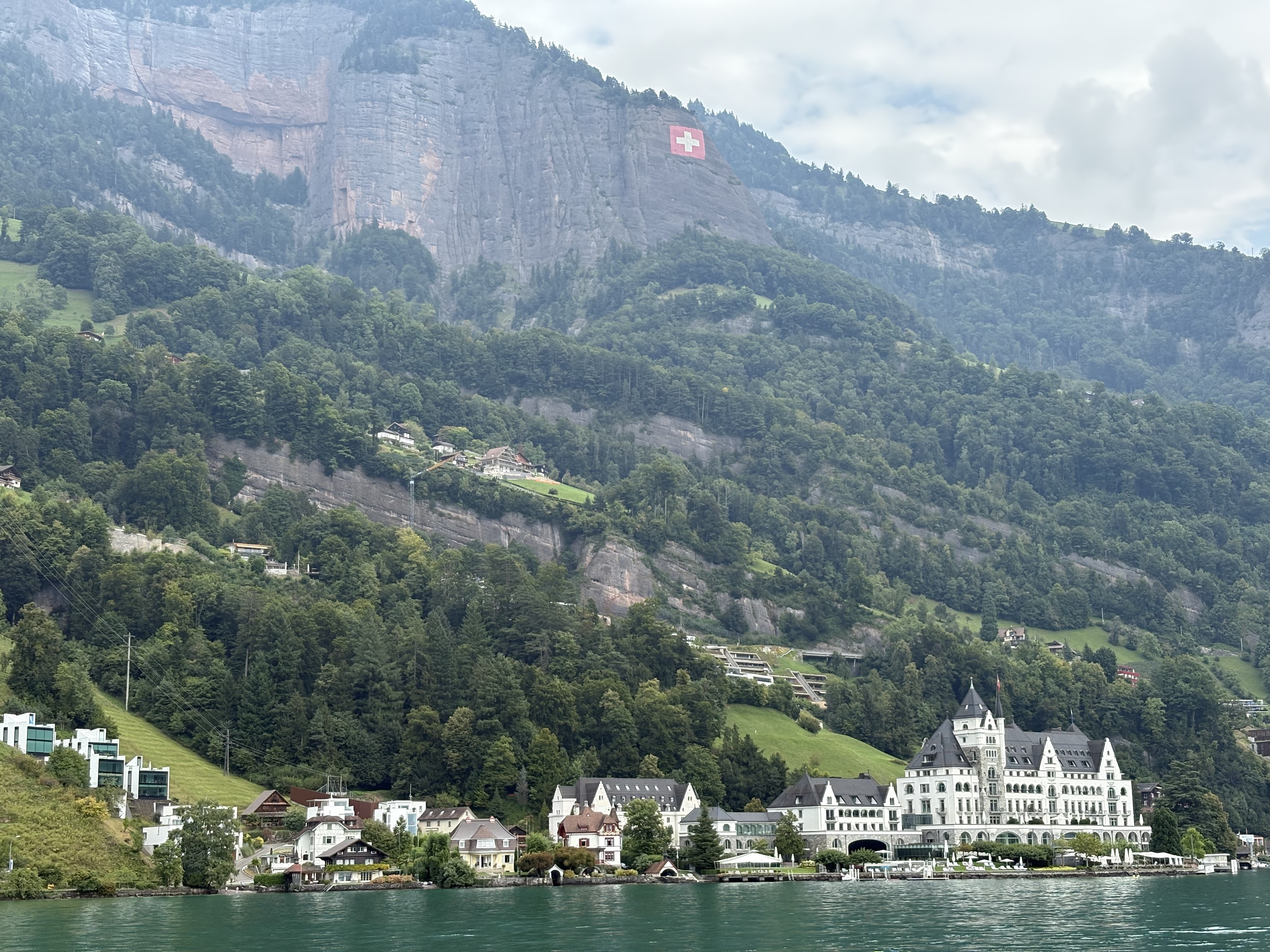 On Lake Lucerne heading to Mount Rigi
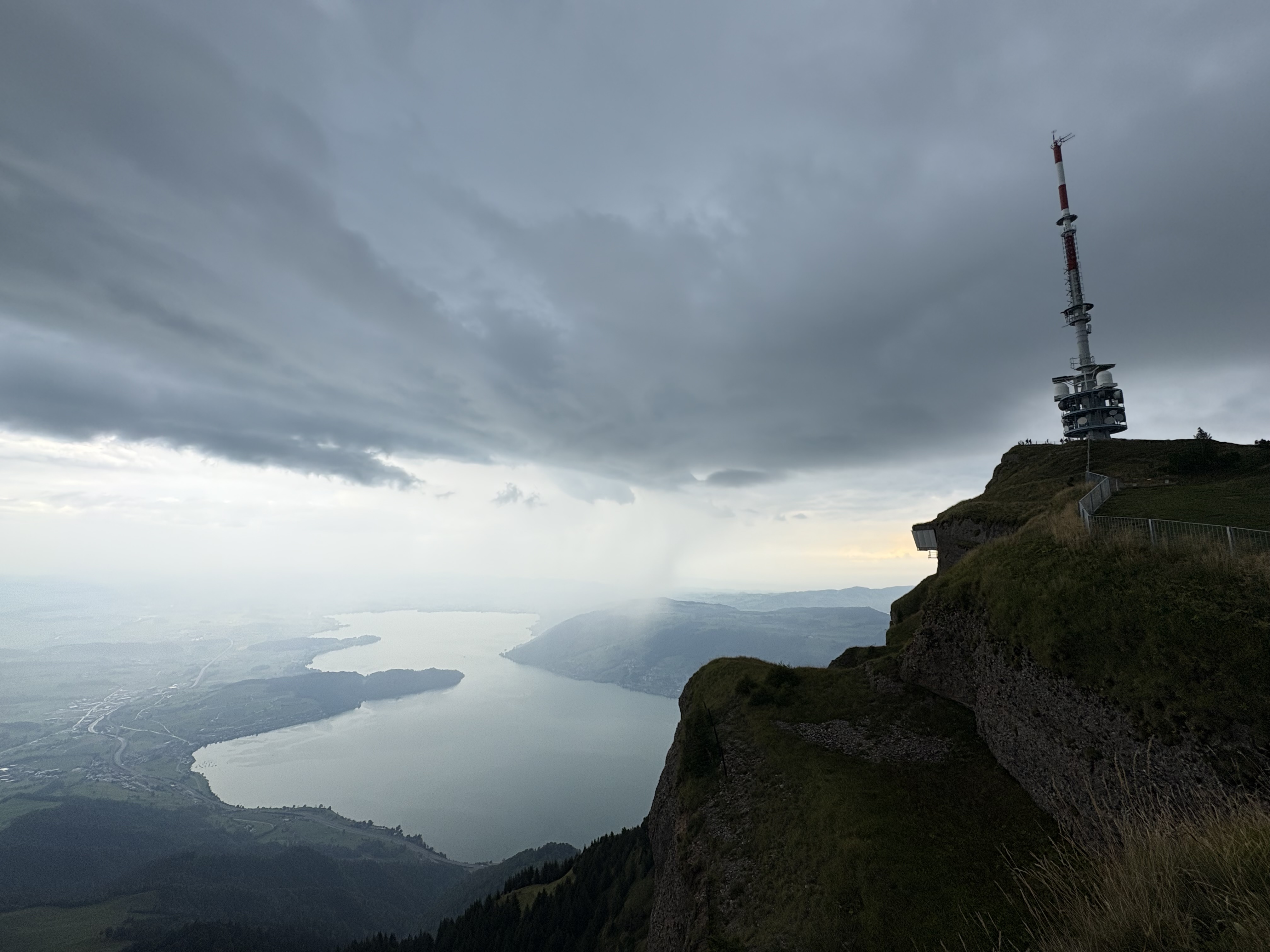 Storm coming on Mount Rigi
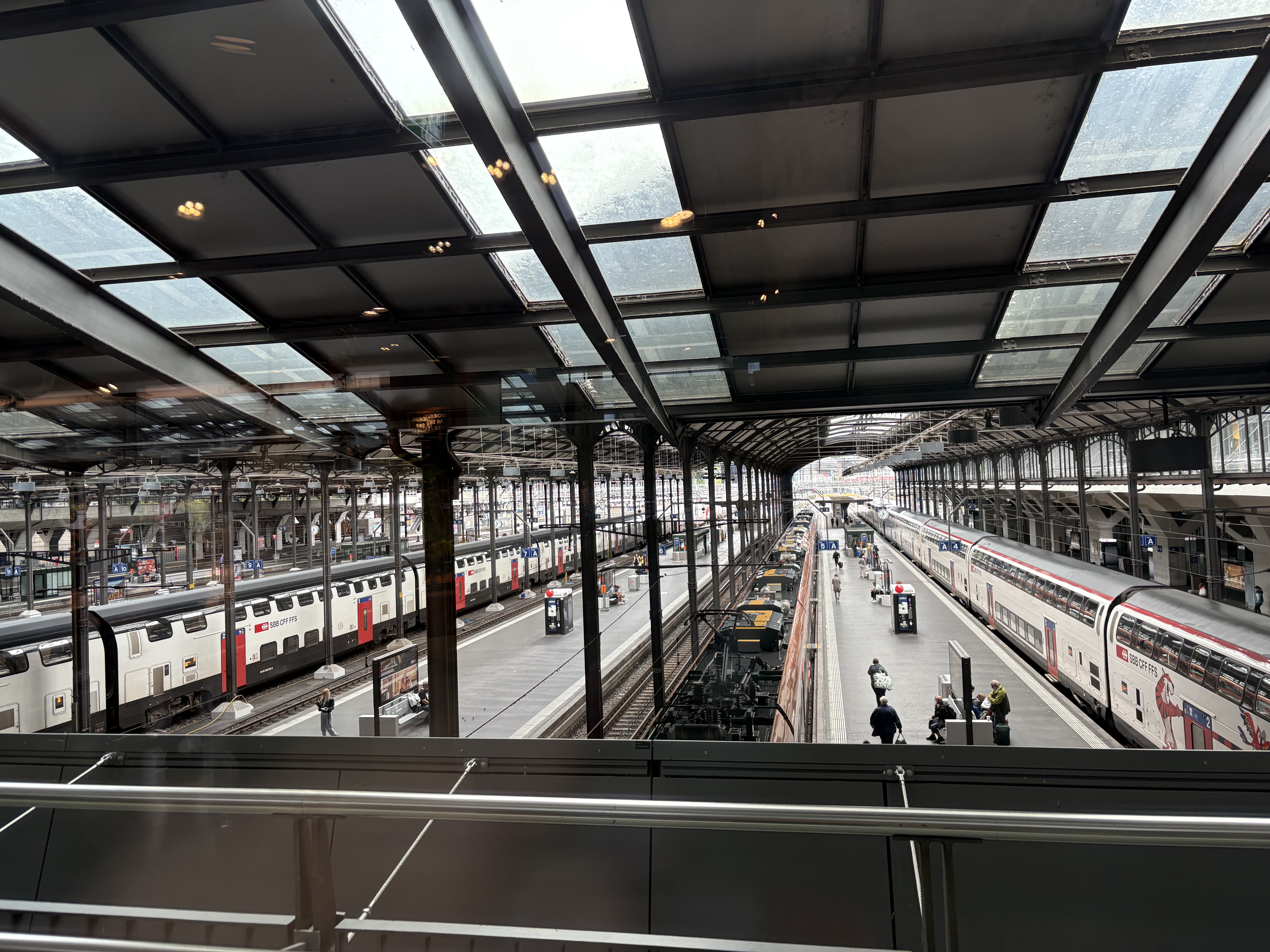 Lucerne train station
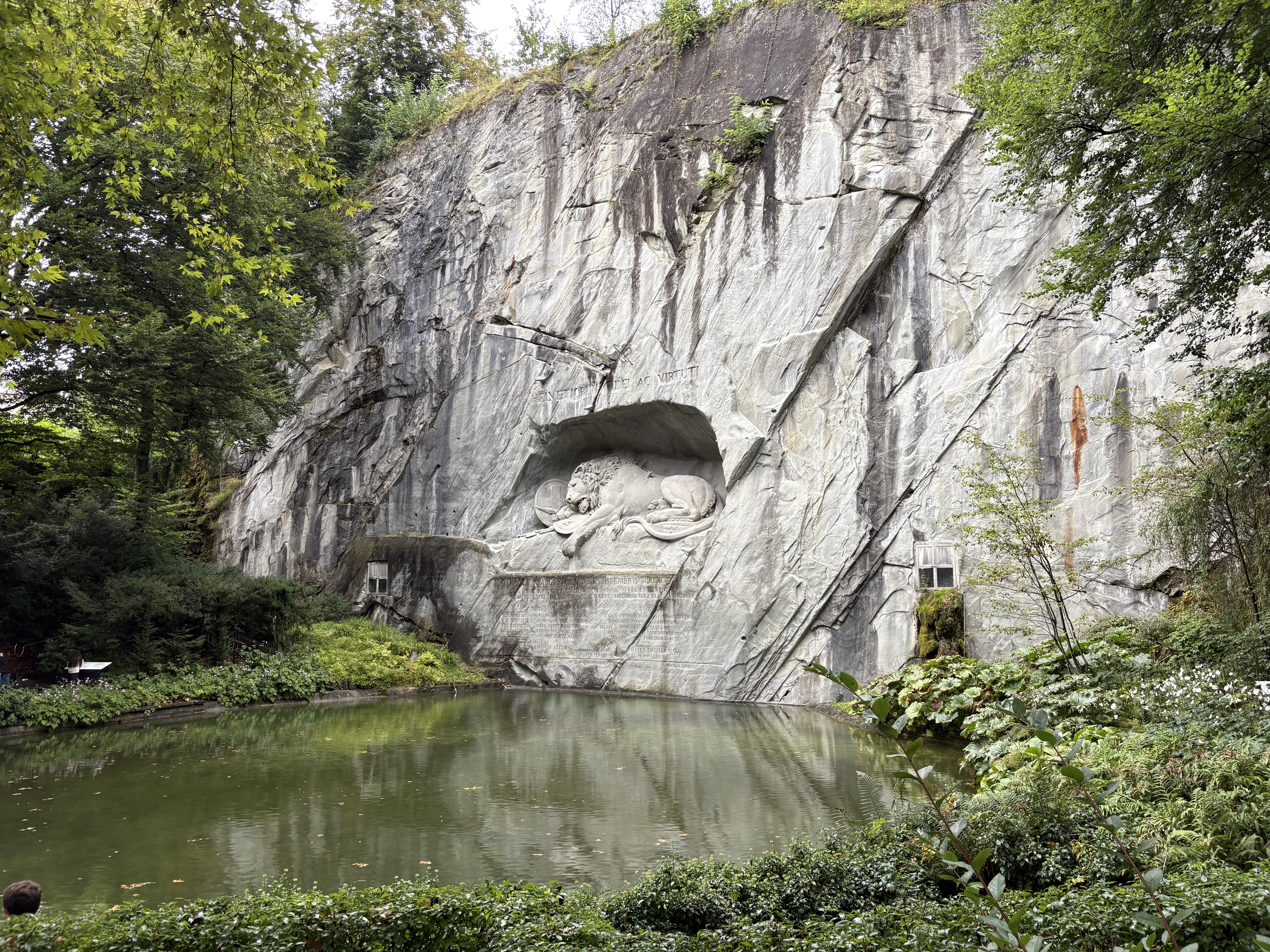 The Lion Monument (Lucerne)
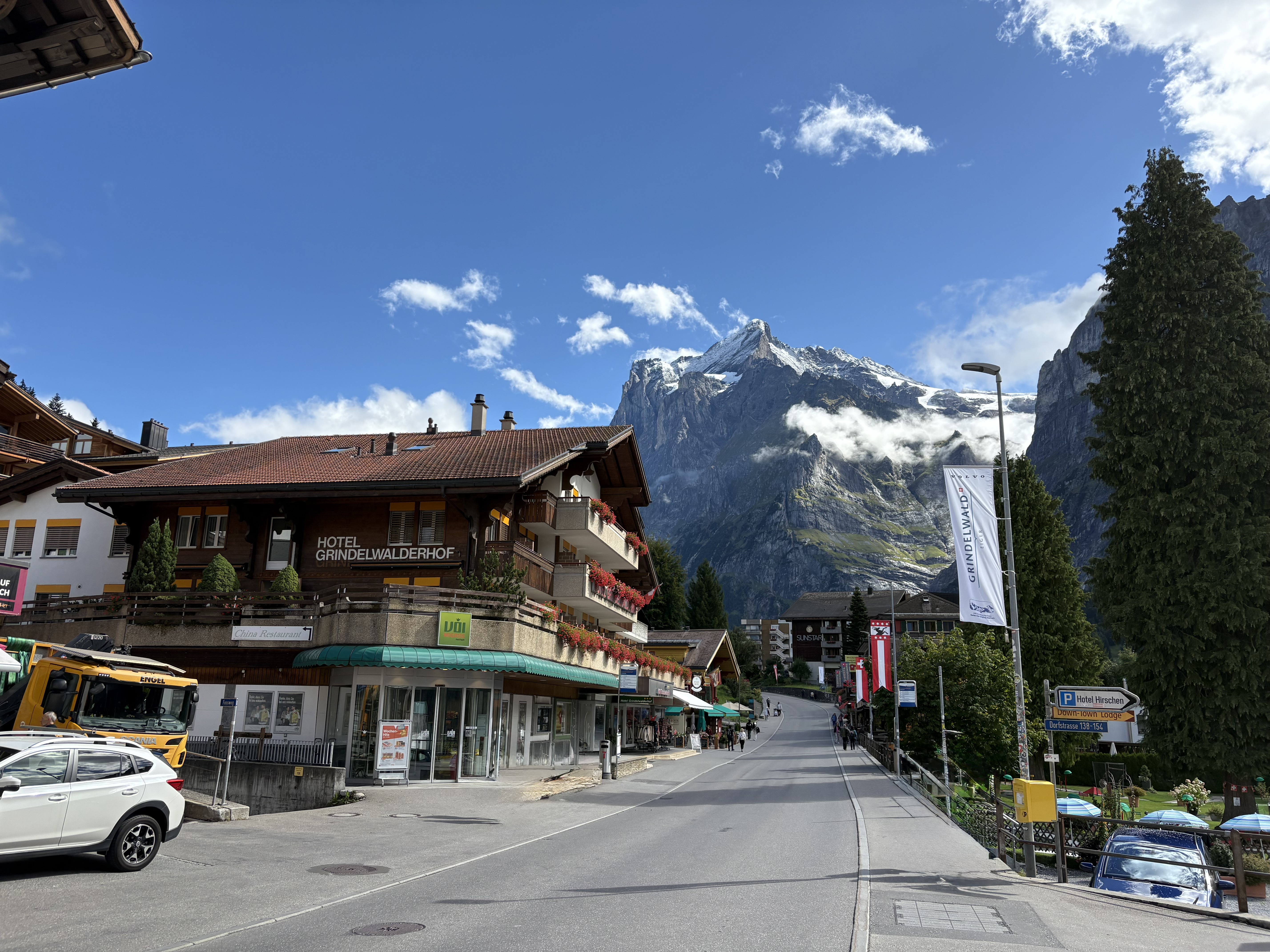 Grindelwald
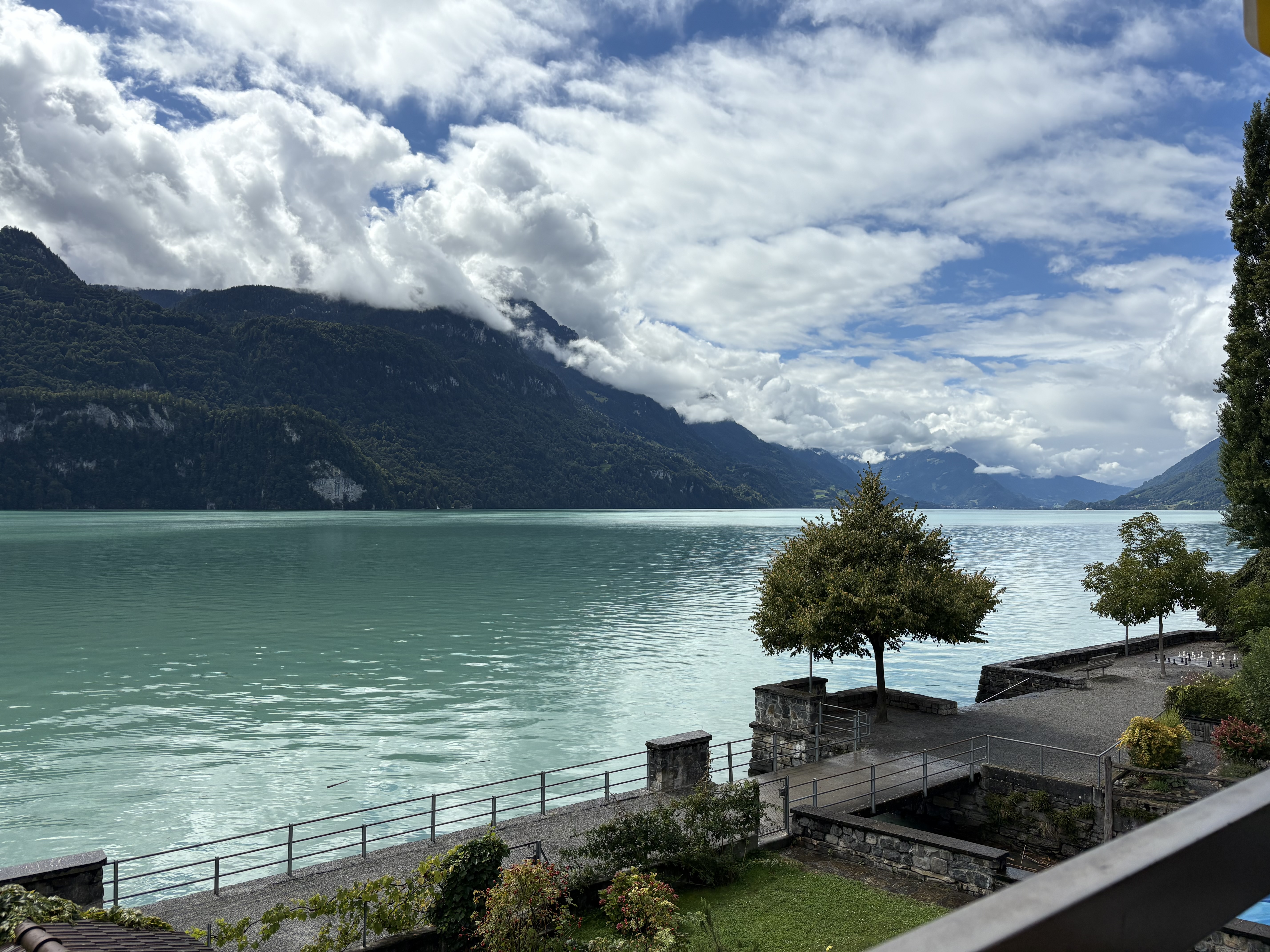 Lake Brienz
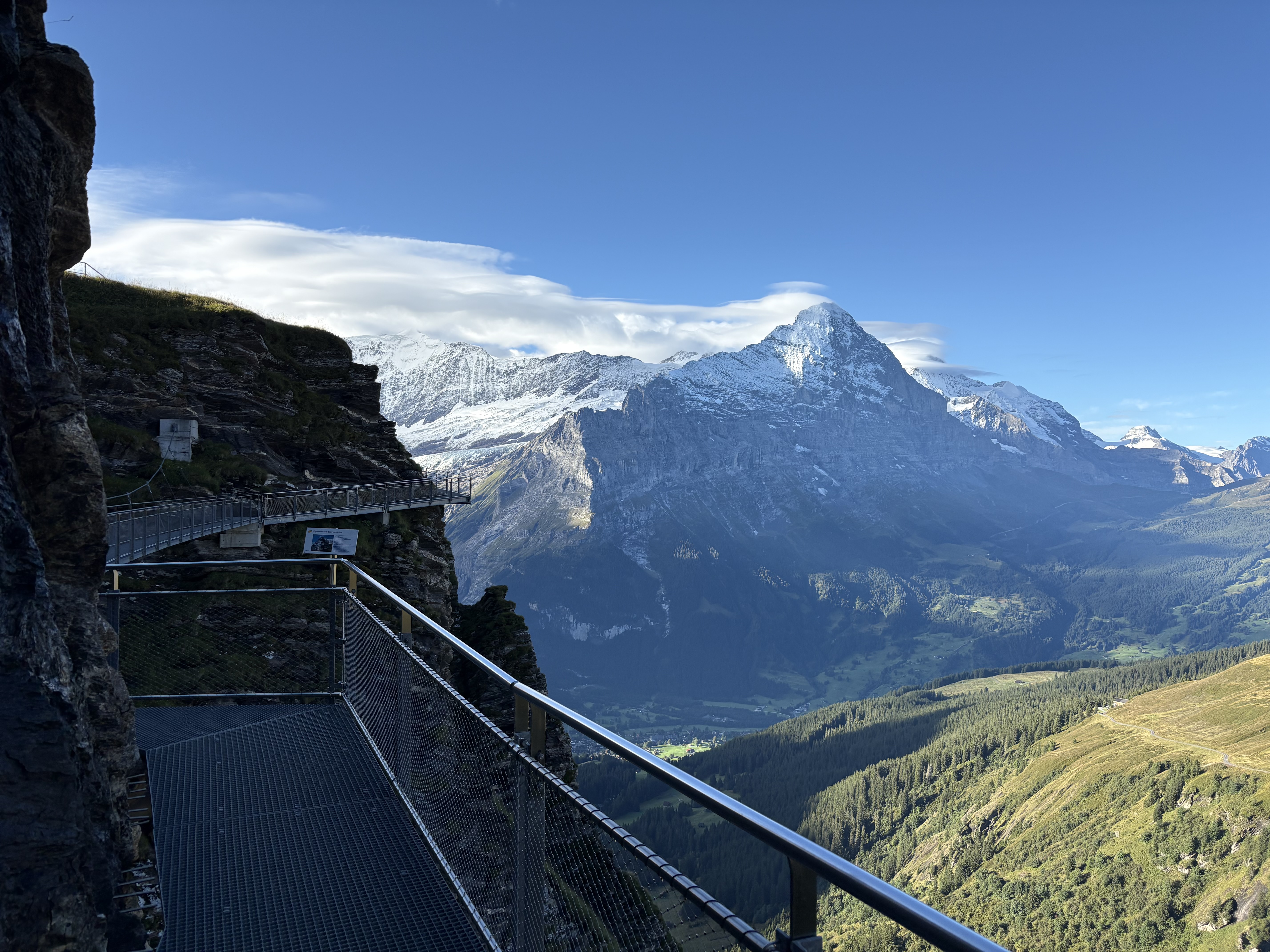 First Cliff Walk

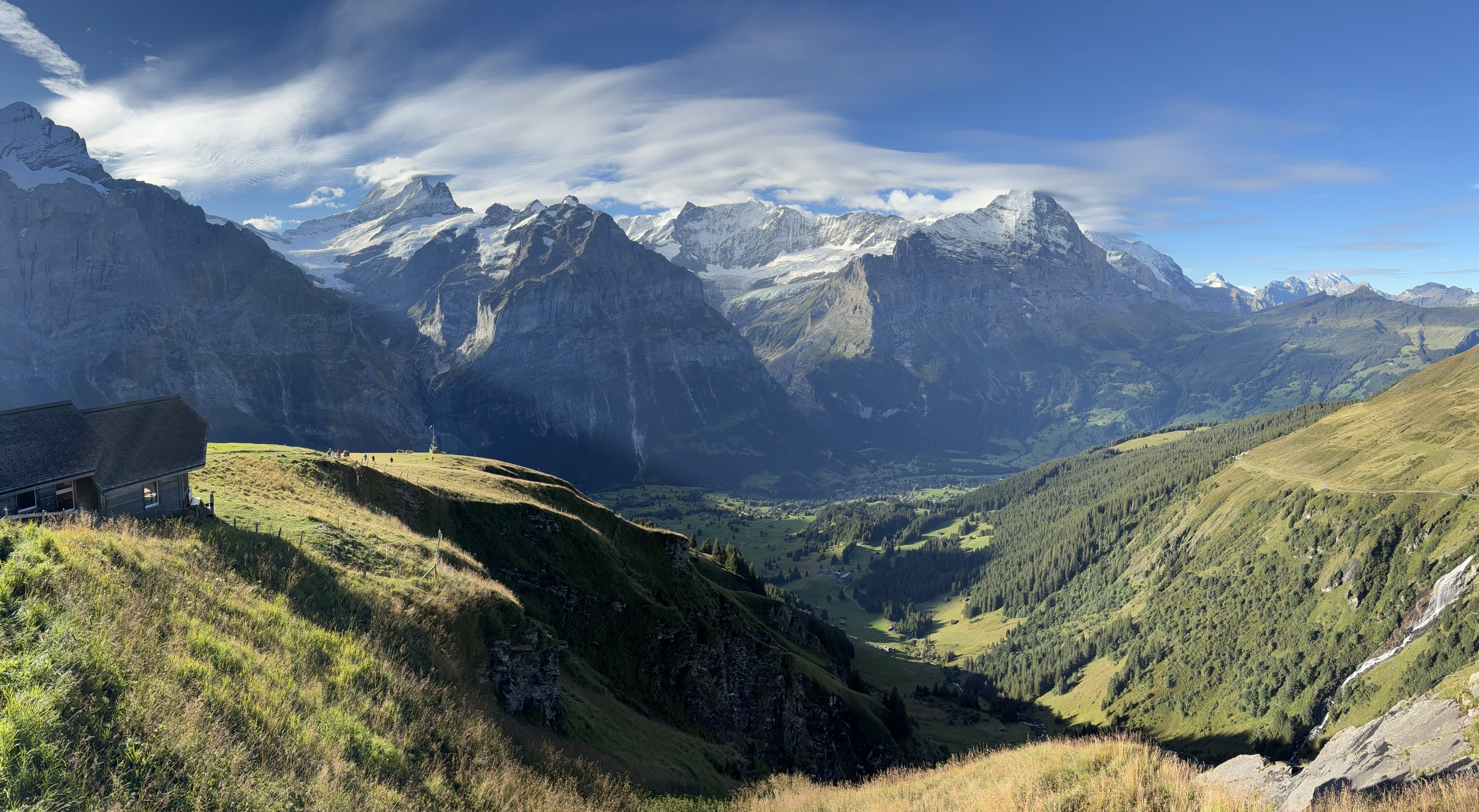 More views from the First
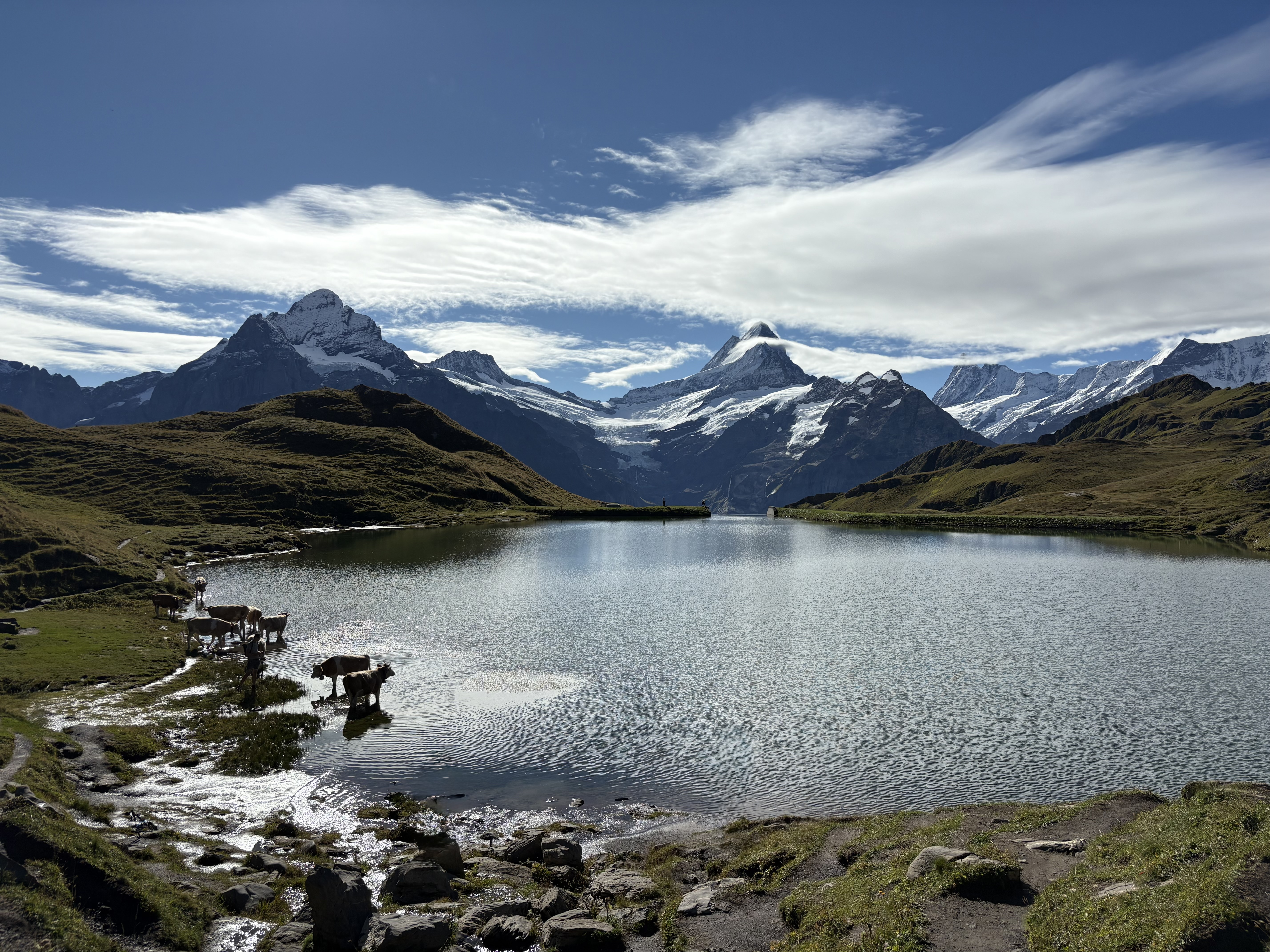 Lake Bachalpsee
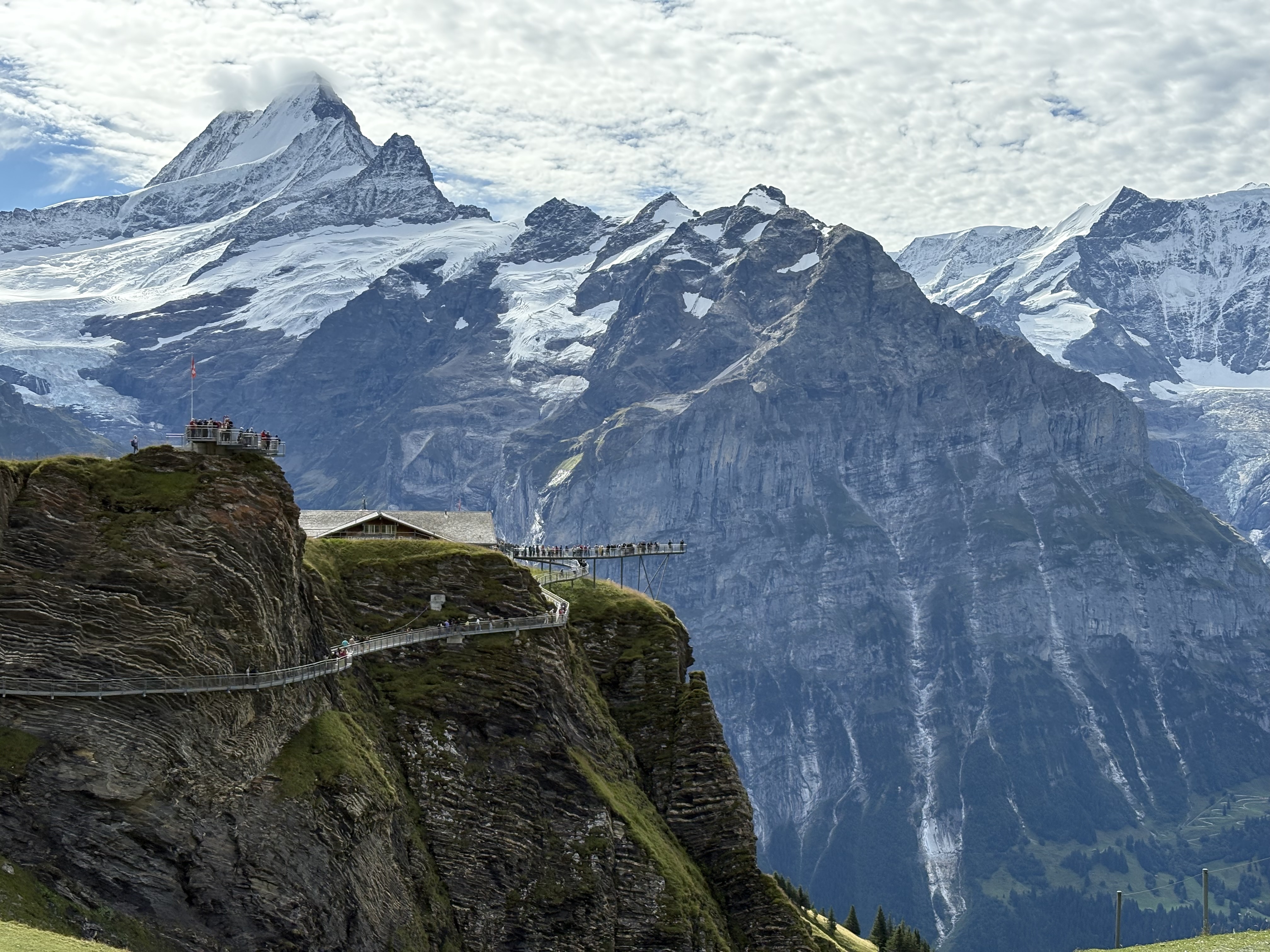 First Cliff Walk from afar
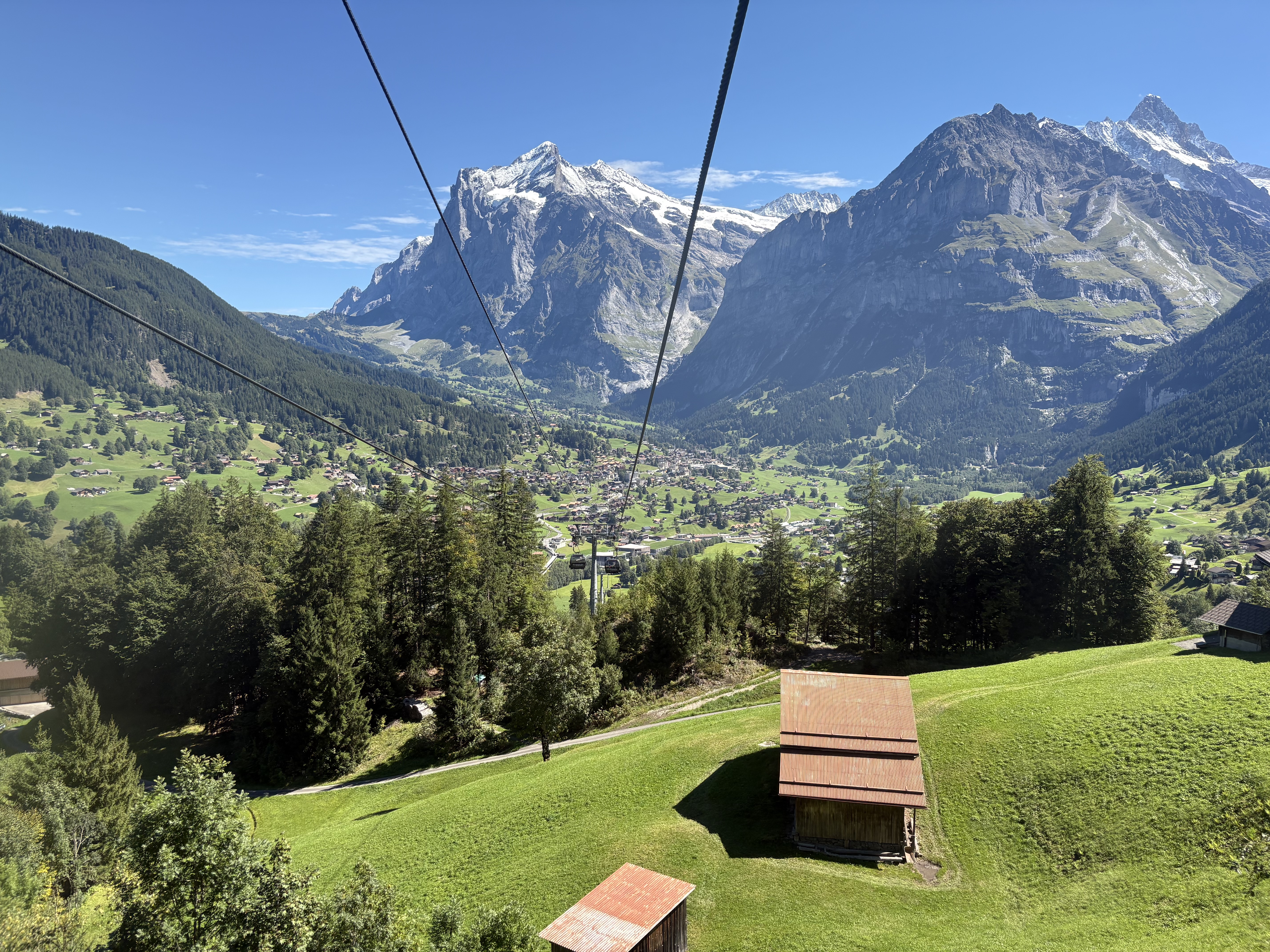 Grindelwald
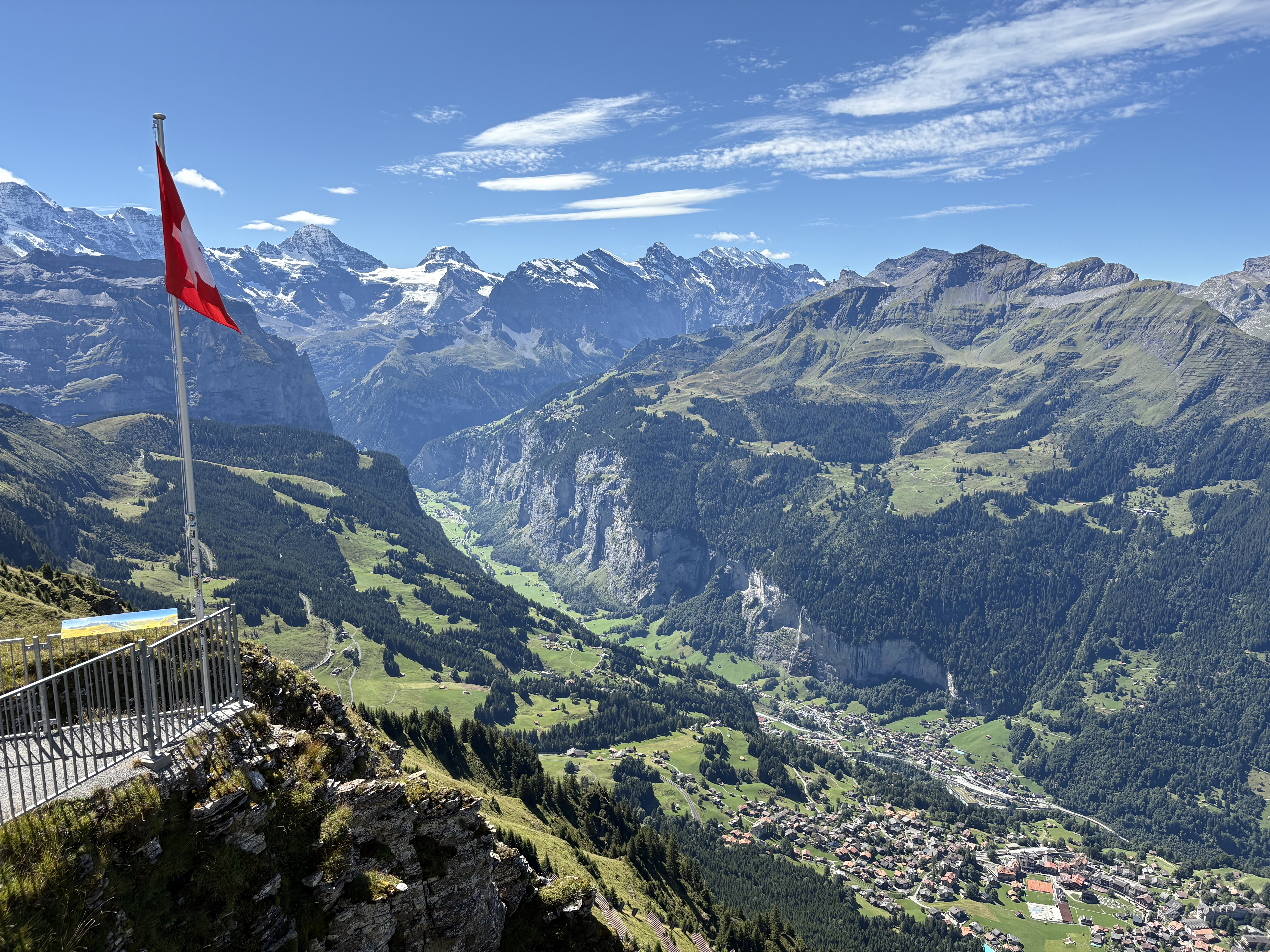 Lauterbrunnen Valley
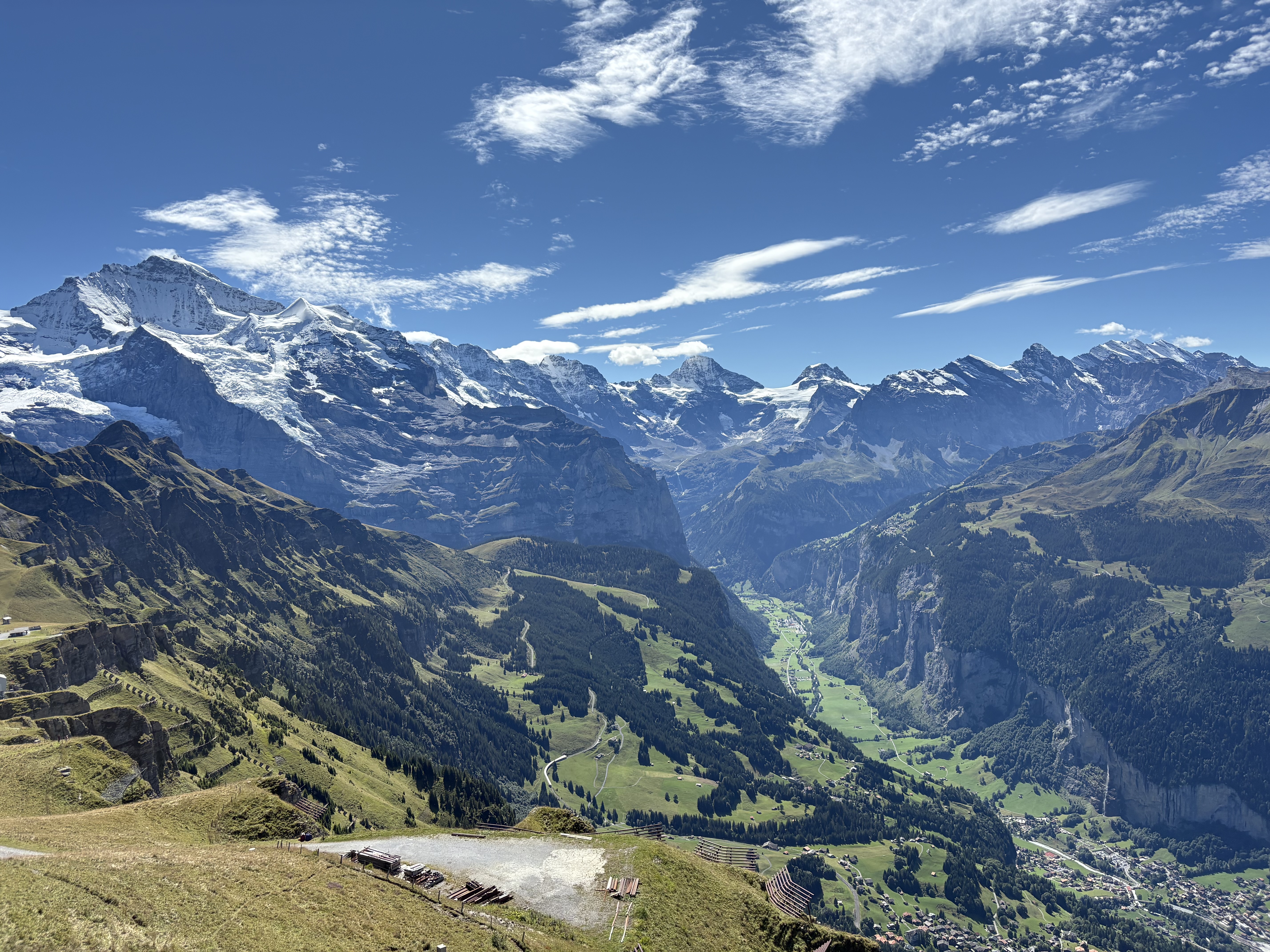 Lauterbrunnen Valley
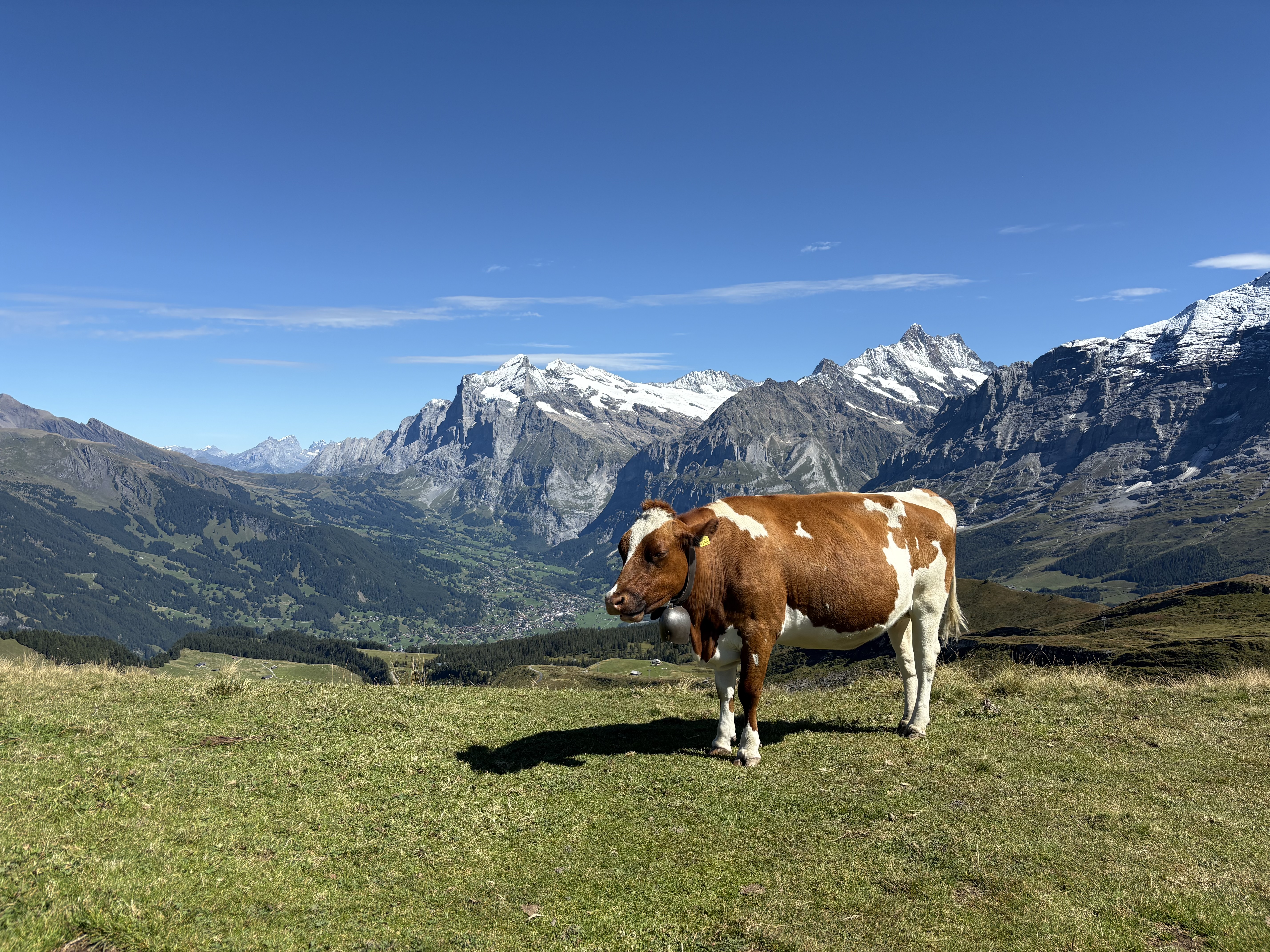 Swiss cow
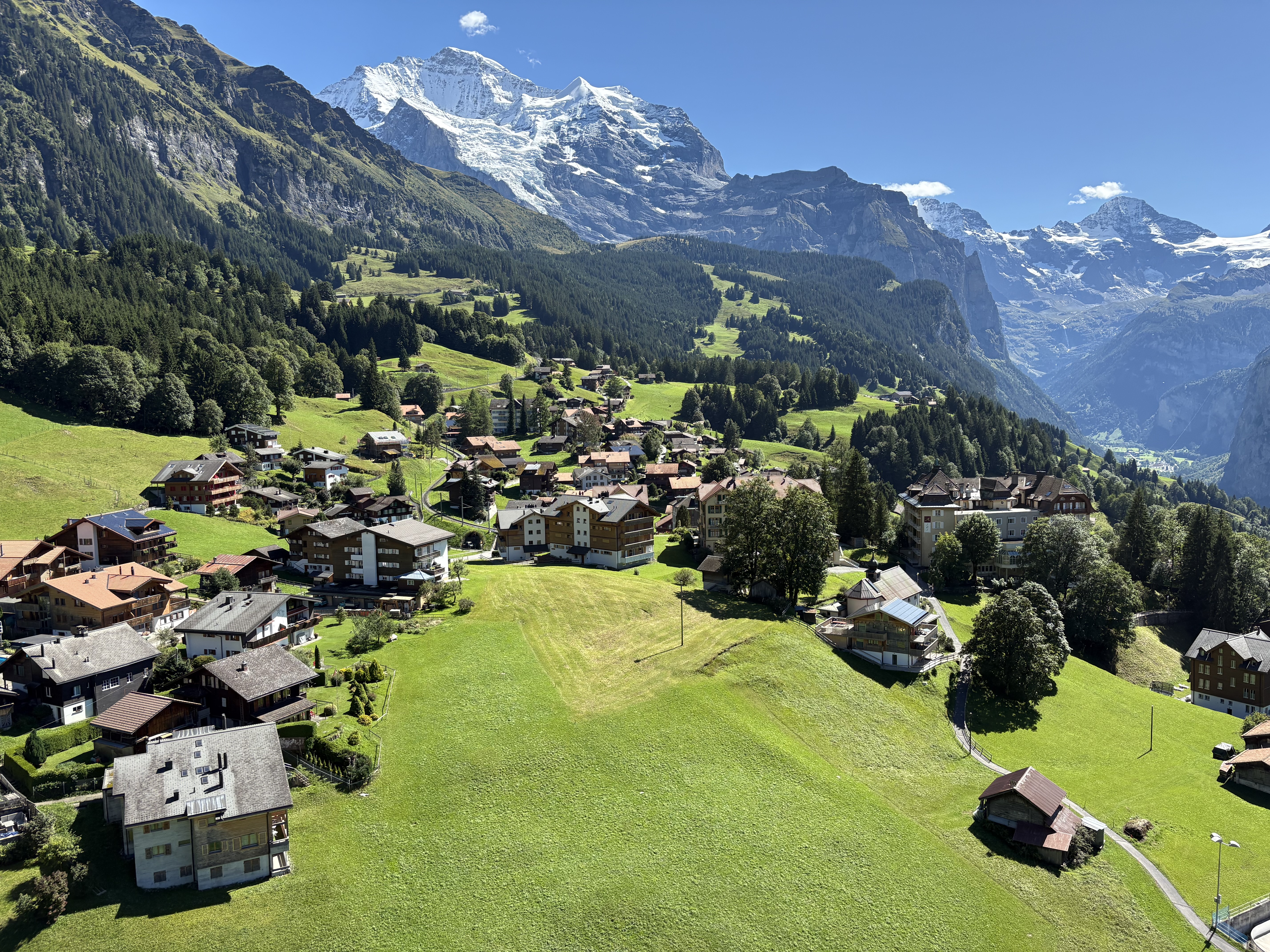 Wengen
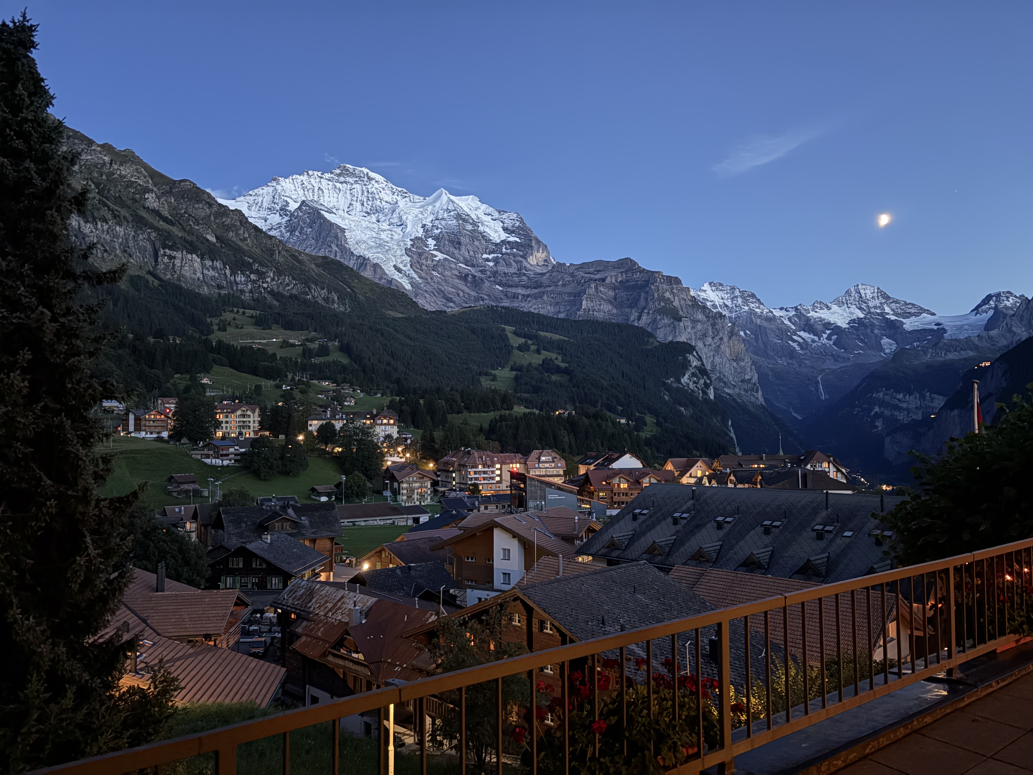 View of the Jungfrau from our hotel in Wengen
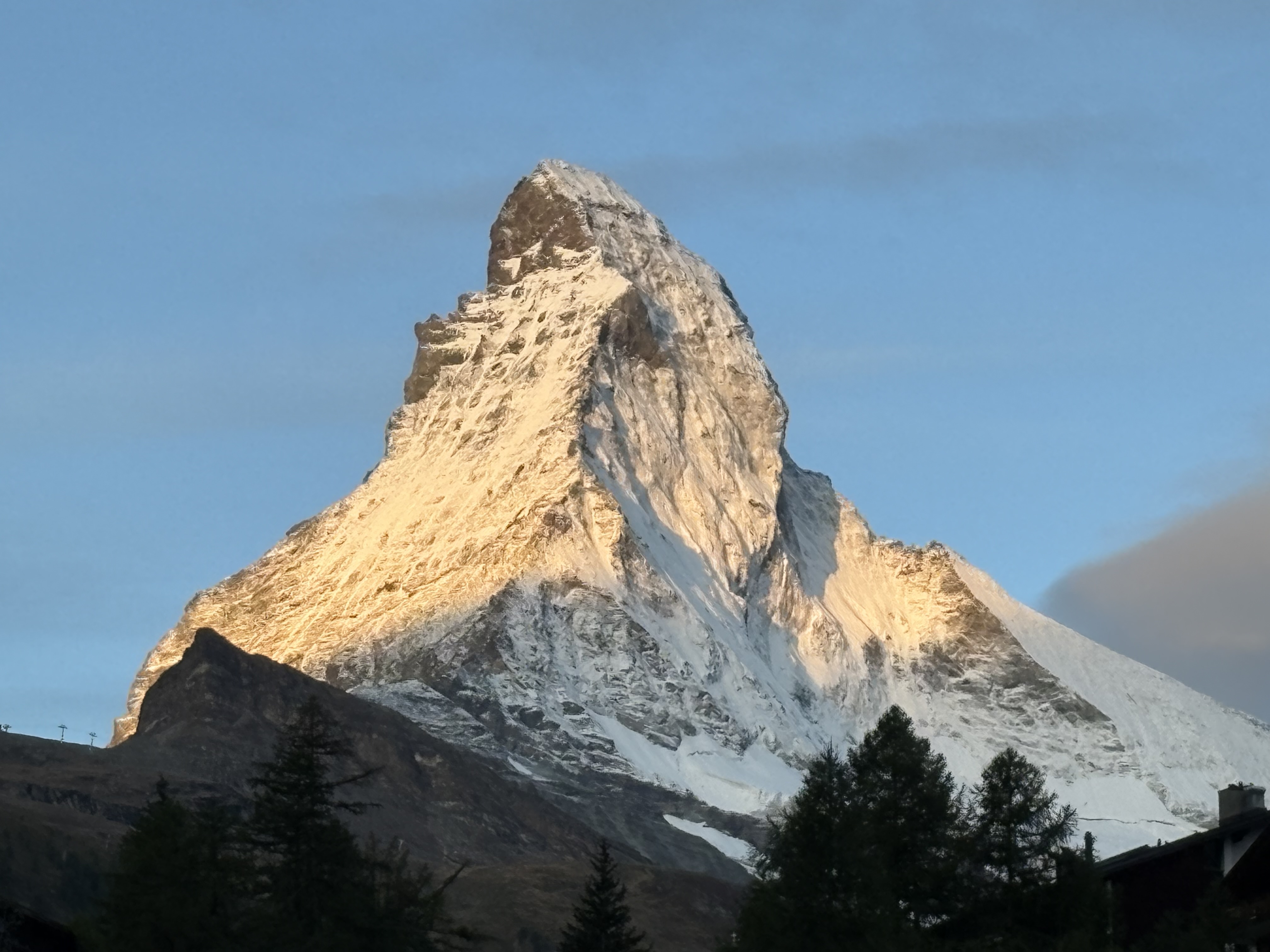 The Matterhorn in the morning
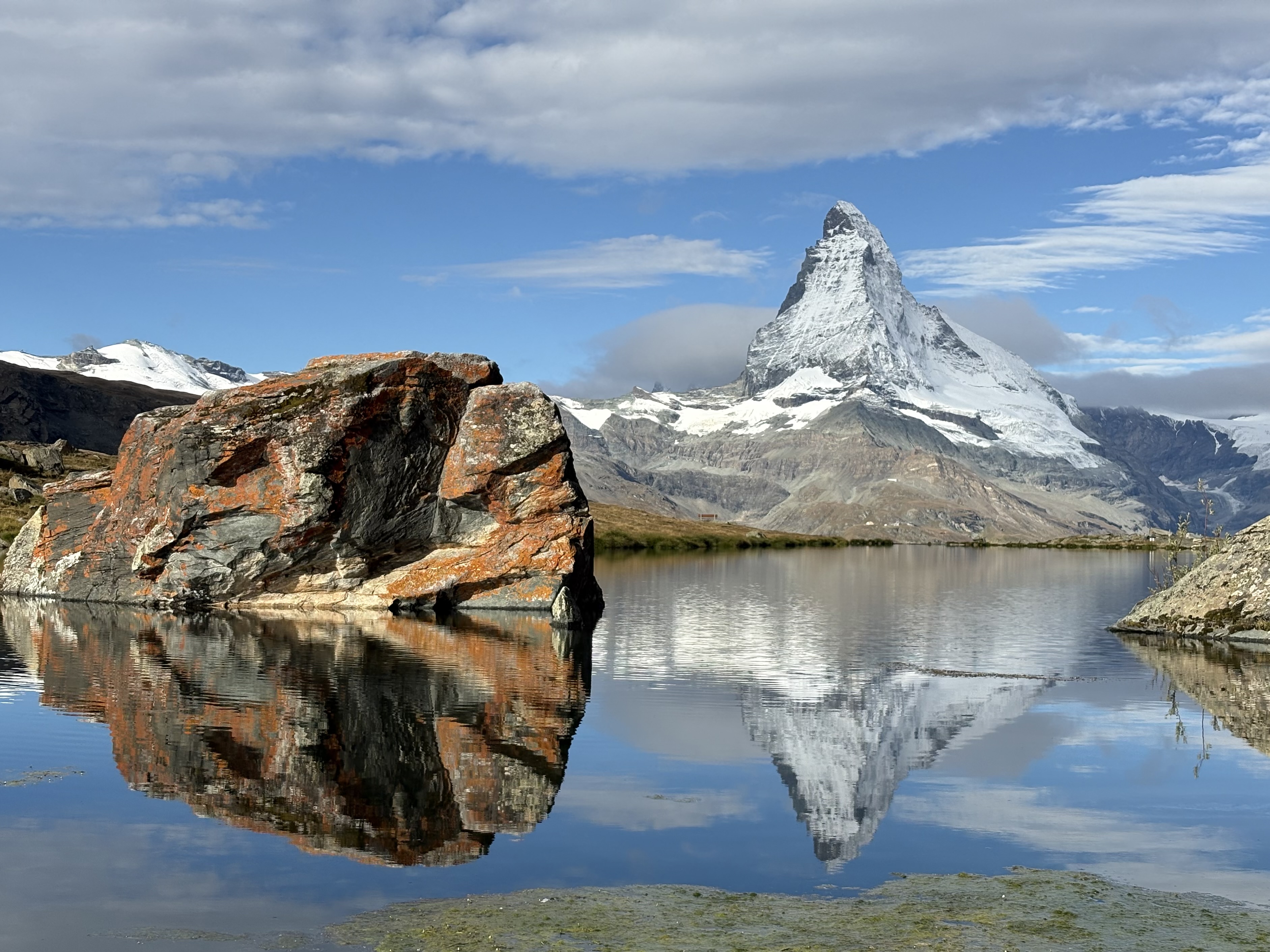 The Matterhorn from the Five Lakes Trail
Bikepacking - SnF reverse final thoughts
I’m really happy I opted for the “long and hard” route from Warm Lake instead of the more direct and “just hard” route that would have taken me past Deadwood Reservoir and then Placerville and Bogus, etc. This definitely felt like more of a “trip” instead of just a ride home with an overnight involved.
It was definitely hard and my body was starting to crack a little on the last day. But, I’m proud with how I fared and feel like I did pretty well without any real focused training. To be able to ride 70-90 miles four days in a row on shitty roads in remote areas with big climbs, a heavy bike, and pretty rustic camping conditions is, I think, an accomplishment I can be proud of even if I didn’t break any speed records.
I have two main goals or motivations for trips like these. The first is to see some beautiful country and be out in nature for days on end. To rough it a bit and pare things back to the essentials: riding, eating, sleeping. The second is to push myself and get a bit out of my comfort zone and to, perhaps, manufacture a bit of adventure in the process.
No way around it, this stuff is hard (at least for me). But I guess that’s the point.
Here are the trip totals:
- Distance: 312 miles
- Climbing: 20,200 feet
- Highest point: 8714 feet (day 2); 8712 feet (day 3)